Tag Archives: participatory map

Information Ecology of Kwadwo Community in Ashanti Region, Rural Ghana

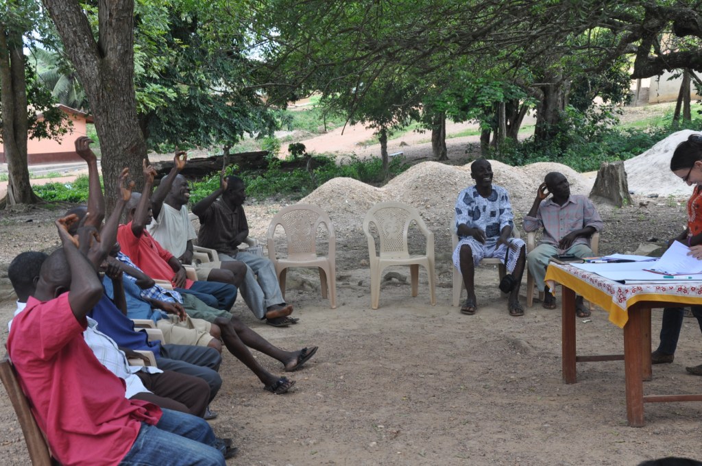
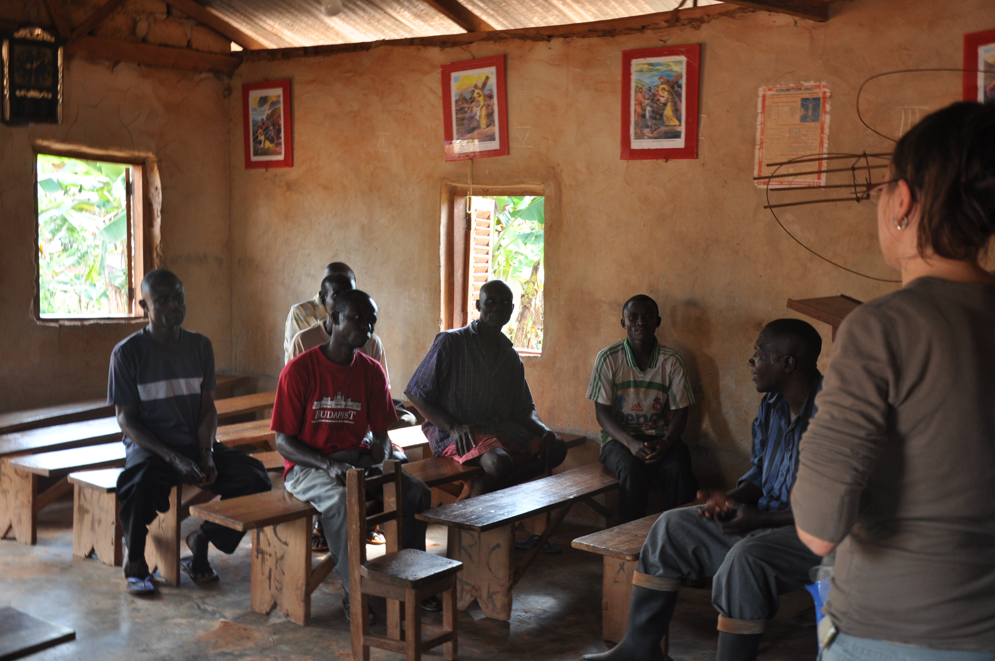
Similarly to the discussion at the Adwoa (anonymized) community, the discussion at the Kwadwo (anonymized) community was organized with the help of extension officers from the district office. The setting selected for the meeting was a local church, which induced a more formal atmosphere into the interactions.

DSC_0024
Church setting

The discussion started by considering recent developments and participants recounted that they did not have electricity until 2008. Nonetheless, as the community has had a surfaced road, its population increased considerably. Immigration into the community was largely due to surface mining activities which take place in the area. Farmers estimated that more than 30 tro-tros (i.e. public mini-buses) visit the community each day. Despite the high level of traffic, there was no newspaper delivery, nor sales in the area. The most memorable adverse event in recent years was the famine of 1983, when many cocoa farms were burnt as a result of the hot weather and absence of rain. Nonetheless, the farms were re-established after the famine was over. In recent years, improved efforts by the public extension office helped improve farmers’ yields. among the remaining problems was black pod disease which still affected yields and the affordability of  fungicide in order to control the disease.

Drawing participatory map
Participatory map

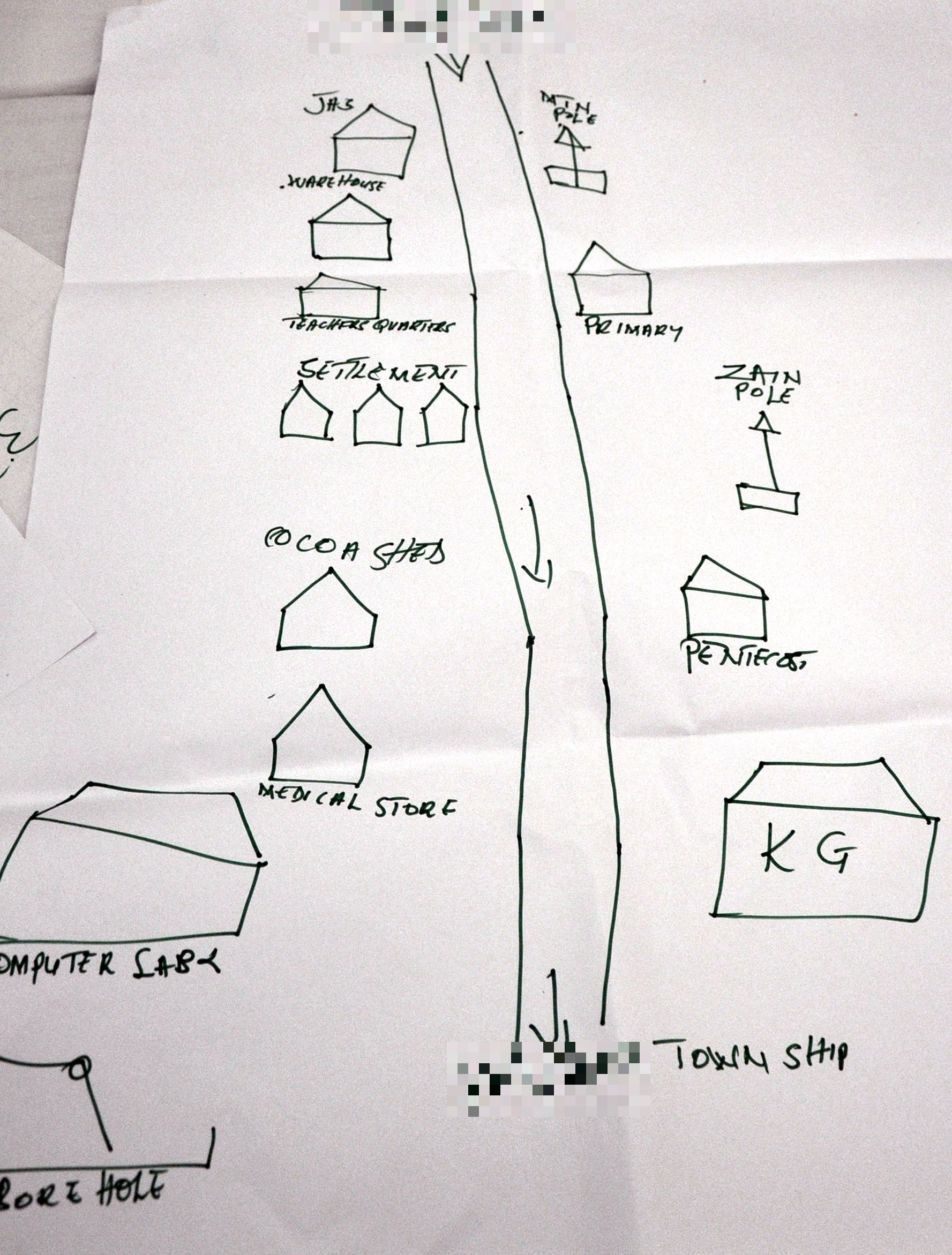
Out of the 13 farmers at the meeting, 9 had access to radios, and they could list more than 20 radio stations which could be received in the area. Farmers tended to use their radios in order to listen to the news. Five out of 13 people in the focus group said they owned television sets but they also said tv signals are not the best. They had access to 4 TV channels: GTV, Metro TV, TV Africa and TV 3. The community had a school but no library. The community had 1 mosque and “uncountable” number of churches. The locations of 4 churches were marked on the participatory map.

Kwadwo information resources

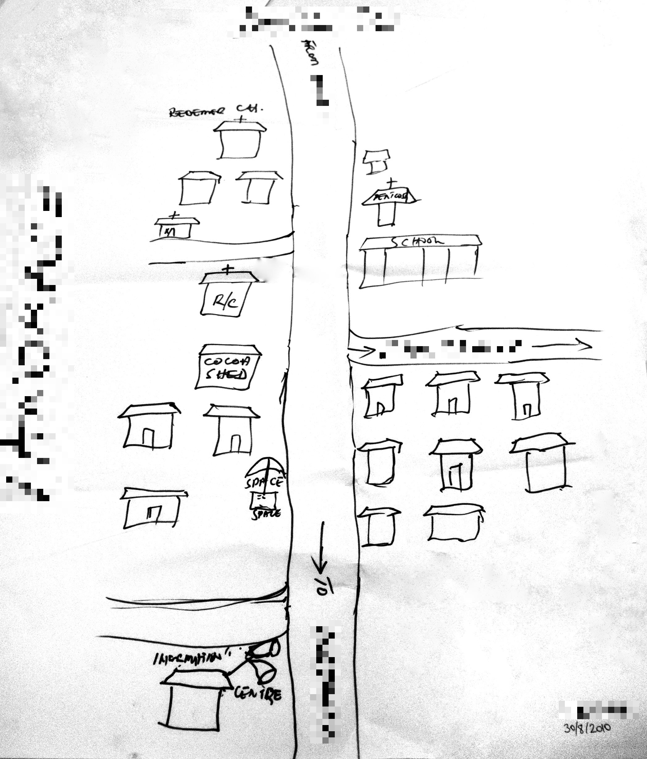
The loudspeaker in the community was known as an ‘information center’, and it served for making announcements about community labour, farmer meetings, funerals and local other information. The fee for announcements (GhC 1) included the announcement being aired twice. Farmers remarked that loudspeakers were often used by salesmen, traveling by car, in order to promote their merchandise (e.g. medicines). The community had no town crier.

Mobile phones were not too common among the farmers in the meeting and only 4 indicated that they own cell phones; out of them had devices with radio functionality. Those who did not own mobile phones made calls from the shared ‘space-to-space’ facilities. These are fixed mobile phone facilities operated by salesmen of mobile credit vouchers. Their location is marked on the map with an umbrella, as they are also known as “umbrella salesmen”.


Information Ecology of Adwoa Community in Ashanti Region, Rural Ghana

Our visit to the Adwoa (anonymized) community in the Ashanti region was organized with the facilitation of the local MoFA agricultural extension agents. The AEA organized attendance by farmers and set up the discussion space with plastic chairs available locally.

Group discussion
Group discussion setting

The focus group discussion started with participants introducing themselves and explaining their relationship to the person seated next to them. The explanations provided were in with traditional rural norms and fellow farmers were often recognized as “a brother” or “a sister,” even when there was no blood relation. More qualified descriptions included “father in farming” or “junior brother”.

Farmers considered the living history of their community and noted that the population of the area has increased considerably in recent years. They noted that some years ago they did not know about fertilizer, row planting, pruning and other farm practices  but all these were introduced to them through assistance from development partners such as the public agric extension office. While the community did not even have a school until recently, in 2010 they had a school with a computer lab. Another important technology that farmers noted had been introduced into their daily lives, was the mobile phone. Adverse developments included, water pollution caused by illegal mining activities, floods during the rainy season which often destroyed farms and poor sanitation.

 Discussion organizers and some active participants
Discussion organizers and some active participants

Farmers drew a participatory map of the information resources in their community which included not only mobile towers for Zain (later Airtel) and MTN, but also shared spaces such as the Pentecostal church and the primary school, and shared activities. As productive activities in the communities are largely centered around cocoa farming, the spaces related to those activities included a “cocoa shed”, a “warehouse”; and a “weighing station” where farmers who traditionally use volume units (e.g. bags, bowls, etc.) could measure their produce and estimate its trading value. Farmers considered themselves fortunate to be growing because COCOBOD (i.e. the parastatal cocoa purchaser in Ghana) would always be ready to buy their produce at fixed prices, irrespective of how much is grown. As cocoa farmers, they did not experience market gluts; like farmers of other crops. An interesting element of the participatory map is the inclusions of a “bore hole” which can be interpreted not only as shared space, but also as shared activity (fetching water).

Participatory map of information resources

Even though the community had a loudspeaker and a town crier, they did not choose to include those on their map of information resources. These resources were used for locally relevant announcements such as communal labour days, immunization campaigns, community meetings, as well as security risks and thefts. Even though they had a computer lab, no adults ever used it because it was part of the school.

Radio was farmers’ preferred source of news and weather, and they tried as much as possible not to miss those broadcasts. They considered weather forecasts to be true most of the time, and used them to decide when to apply fertilizer and to perform other farm activities. 17 out of 18 farmers reported having access to a radio, and 10 reported having access to the radio on their mobile phones.

With regards to mobile phones, out of the 18 participants 13 (10 men and 3 women) had access to mobile phones. They tended to be mid-range phones with LCD displays. On average, they reported purchasing GhC 2.5 of phone credit per week. As the Adwoa community had no access to the electricity grid, farmers tended to charge their phones at the base stations of the two mobile companies (Zain and MTN) which were located within their community. Security staff at the facilities could be persuaded to charge phones for the fee of GhC 0.50. Even though they had no electricity, 3 out of 18 farmers owned TV sets indicating the symbolic significance of TV ownership.